|
|
|||||
|
|
|
|||||
|
|
|
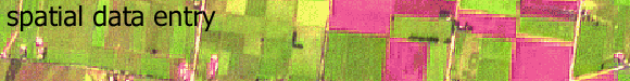
Welcome to the Spatial Data Entry self learning tool. On completion of this interactive learning module, students should have an understanding of the operations required to create both raster and vector databases from various input sources. There are four major components to this module: Specific Theory, Worked Examples and Questions with Feedback. For best results, it is suggested that students work through all components of the module in sequential order. Please select
the component of your choice to begin: |
|
| Specific
Theory Introductory theory and concepts, incorporating the database structure concepts, cell sizes, resolution and scale. |
|
|
Worked examples of determining eastings and northings, and digitising control points. |
|
| Questions
With Feedback Questions which require the student to apply knowledge learnt in the previous sections. |
|
| Click here to download all theory presented in this module | |
|
|
|