|
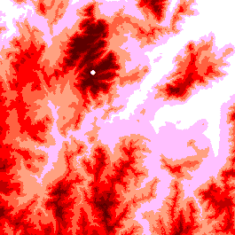
viewshed
The white dot shows a possible location for a fire spotting tower.
The viewshed algorithm works outwards from this point computing
those areas of the landscape that are visible (green) at each
distance. Thus, areas in which fire might not be visible are readily
identified.
When the distances involved become greater than around 10 km,
the curvature of the earth should be taken into account.
|